

Yesterday, the LANDSAT-8 satellite orbited over Iceland and captured pictures of the eruption at Geldingadalur with its high tech camera.
The natural history group at the University of Iceland published the new photos on their Facebook page.
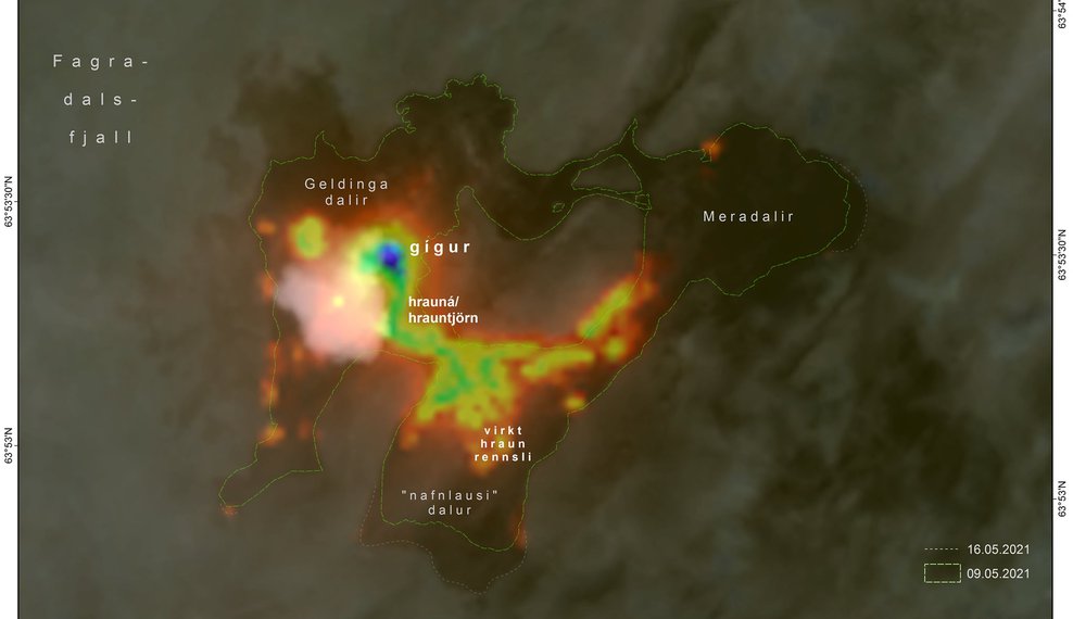
The photos taken from the LANDSAT-8 satellite were taken at an altitude of about 705km above the Earth’s surface. The satellite has an infrared scanner and the heat and lava pools are clearly visible in the picture.
The post on Facebook states: “The scanner on board the satellite is sensitive to numerous wavelengths, which allows users to view various properties of the Earth’s surface.
“By looking at the central and near-infrared radiation in particular, it is possible to distinguish between craters, lava rivers, active lava edges and other surfaces.
“Today’s picture clearly shows how much activity there is in Geldingadalur and Meradalir. Fine lines also show the major changes over the past week.
“The most attention will probably be given to the areas to the south where parks are being prepared to stop / delay lava flows towards the south coast.”
Note: Due to the effect the Coronavirus is having on tourism in Iceland, it’s become increasingly difficult for the Grapevine to survive. If you enjoy our content and want to help the Grapevine’s journalists do things like eat and pay rent, please consider joining our High Five Club.
You can also check out our shop, loaded with books, apparel and other cool merch, that you can buy and have delivered right to your door.
Also you can get regular news from Iceland—including the latest notifications on eruptions, as soon as they happen—by signing up to our newsletter.


