

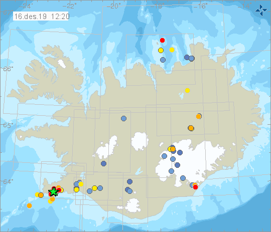
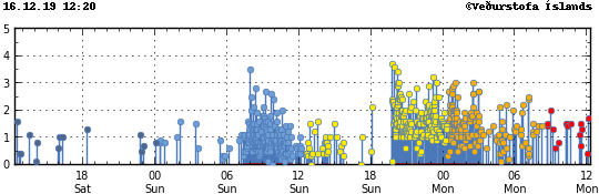
Over 400 earthquakes have been recorded since Sunday morning in the Reykjanes peninsula. However, none registered over 3.7 in magnitude, according to the Icelandic Meteorological Office (IMO). This is no reason for alarm; the area is known for being seismically active.
Driving from the Keflavík International airport, the alien-looking landscape is filled with natural and geological wonders such as lava fields, geothermal areas, and active volcanoes. The Reykjanes peninsula is home to the Reykjanes Geopark; five volcanoes make up the its geological landscape.
However, the latest eruption was last recorded in the 14th-century and actually created the lava field near Lake Hlidarvatn. Nonetheless, the area’s geological makeup, together with the fact that it’s where two continental plates connect – the European and the North American – makes it a fertile ground for, usually, harmless but frequent seismic activity. According to Visír, in July 2017, Reykjanes felt about 600 earthquakes, with the largest quake being a 4.0.
That said, Reykjanes was the epicenter for the quakes but the activity was felt in the whole peninsula, such as Keflavík, Grindavík, and Akranes and even in the capital area. Even though the peninsula is known for being a place for more recurrences of earthquakes, they could possibly happen anywhere in the country, considering the great number of active volcanoes.
All things considered, these quakes do not present any danger for anyone living in the areas or visiting, so don’t be concerned.


