

Another earthquake has shaken up parts of Iceland. This time not (only) in the north, which has been shaken by a series of earthquakes in the past weeks, but in the southwest.
According to the Icelandic Meteorological Office, reports have been received that the earthquake was felt in Grindavík and Reykjanesbær.
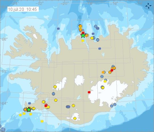
The earthquake measured 3.3 in magnitude and occured around 16:12 yesterday afternoon. It’s the strongest earthquake in the area since June 13 when a 3.5 quake was measured. Tremor activity has persisted in the region in recent months also in connection with landslides.
According to RÚV, Einar Bessi Gestsson, a natural resources specialist at the Icelandic Meteorological Office, says the quake has now occurred in similar areas, southeast of the volcano Mt. Þorbjörn, which is very close to Grindavík. “This is the same area and similar activity that’s been going on in recent months,” he says.
The Reykjanes region made headlines last March when earthquake clusters and groundswelling due to magma intrusion was detected near Mt. Þórbjörn. While things have calmed considerably since then, scientists are still regularly monitoring the area.
There is no indication that the volcanic eruptions have ended. “This has happened to us in cycles,” Einar says, not ruling out that more earthquakes will follow.
Note: Due to the effect the Coronavirus is having on tourism in Iceland, it’s become increasingly difficult for the Grapevine to survive. If you enjoy our content and want to help the Grapevine’s journalists do things like eat and pay rent, please consider joining our High Five Club.
You can also support us by checking out our shop, loaded with books, apparel and other cool merch, that you can buy and have delivered right to your door.


